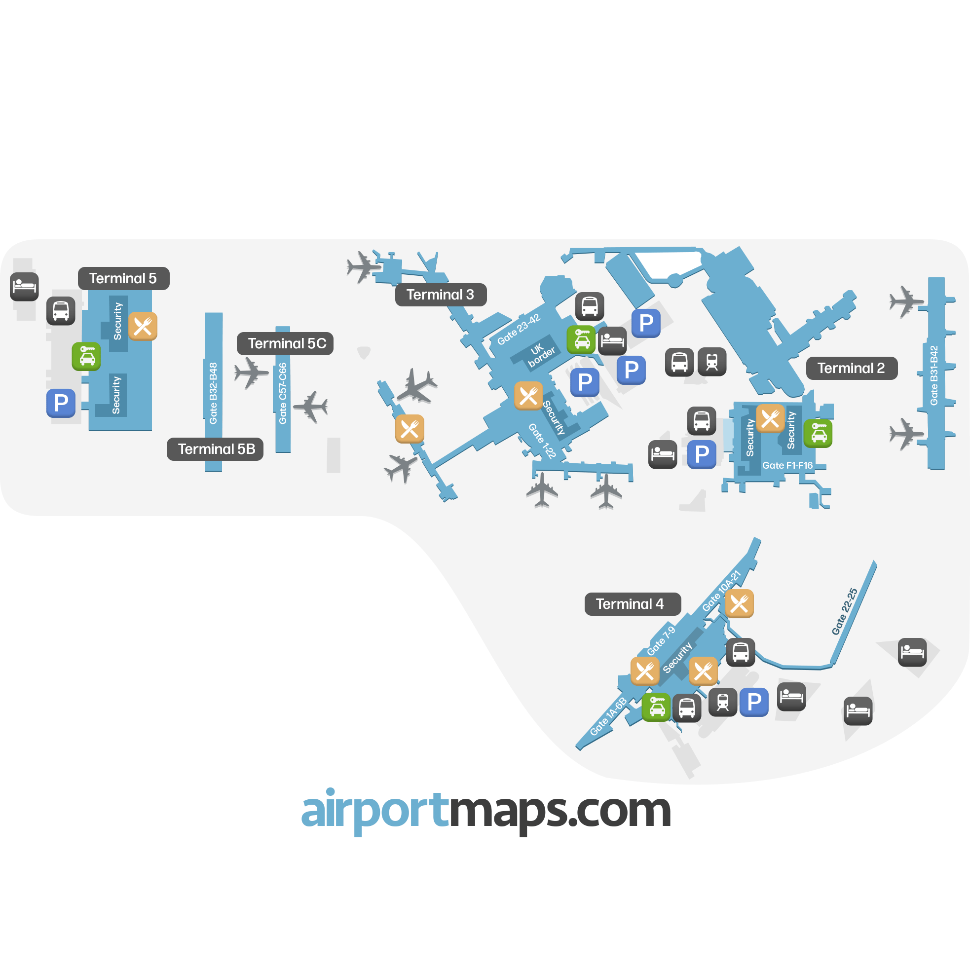
London Heathrow is one of the busiest airports in the world – here we help you find your way around the main international airport in the United Kingdom.
![]()
![]()
![]()
Food
![]()
Bus
![]()
Train
![]()
Security
![]()
Parking
![]()
Car rentals
![]()
Hotel
![]()
Food
![]()
Bus
![]()
Train
![]()
Security
![]()
Parking
![]()
Car rentals
![]()
Hotel
In London you find a number of international airports, with Heathrow being the biggest one. The airport is actually the busiest airport in Europe, and one of the busiest in the world. Heathrow is located about 23 kilometers west of the central parts of London and is the primary hub for major airlines British Airways and Virgin Atlantic.
When it comes to hotels at London Heathrow, there are a number of options to choose from with at least one hotel at each terminal. You find both budget options and hotels that have a little higher rating, depending on what kind of stay you are looking for.
As previously mentioned, to get to the central parts of London from Heathrow requires a little bit of transportation. Here you have several different options, with one of the most popular ones being to go by train with Heathrow Express. The express train departs every 15 minutes and takes 15-20 minutes depending on which terminal you are traveling from.
Another option is to choose to go by bus, either by public transportation, a hotel shuttle or by an on-demand minibus. At Heathrow you also find the majority of the major car rental companies in Europe.